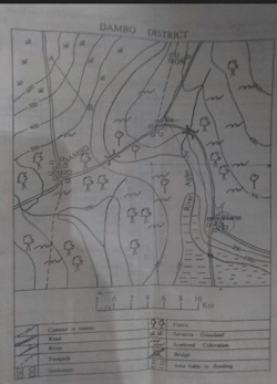
Concept:Map interpretation: determining the land characteristics of the southeastern portion of the map.Explanation:The southeastern part of the map area consists of low-lying, swampy land. Such terrain indicates that water accumulates and does not flow away easily. This condition is best described as poor drainage rather than as a plantation, lake, or ocean.Answer:A. poorly drained