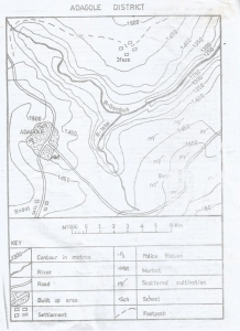
Concept:The contour interval is the vertical distance between two consecutive contour lines on a topographic map.
Explanation:Contour lines join points that have the same elevation above sea level.
The contour interval tells us the height difference between one contour line and the next.
To determine it, compare the elevations shown on adjacent contour lines on the map.
On this map, successive contour lines differ by
100 metres in height.
Therefore, each time you move from one contour line to the next, the elevation changes by
100 metres.
This constant vertical spacing is the contour interval for the whole map.
Answer:B. 100 metres