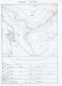
Concept:Farming areas are identified by the density of cultivated plots and farming settlements shown on the map.Explanation:The South-Western part of the map has the highest concentration of cultivated plots and farming settlements.Other parts of the map show fewer signs of farming activity.Therefore, farming is most common in the South-Western section.Answer:C. South Western part of the map